
Official tourism website for Mourne Gullion Strangford
En

Ross Monument EHOD 2026

Warrenpoint Road, Rostrevor, County Down, BT34 3EB
Ross Monument

About

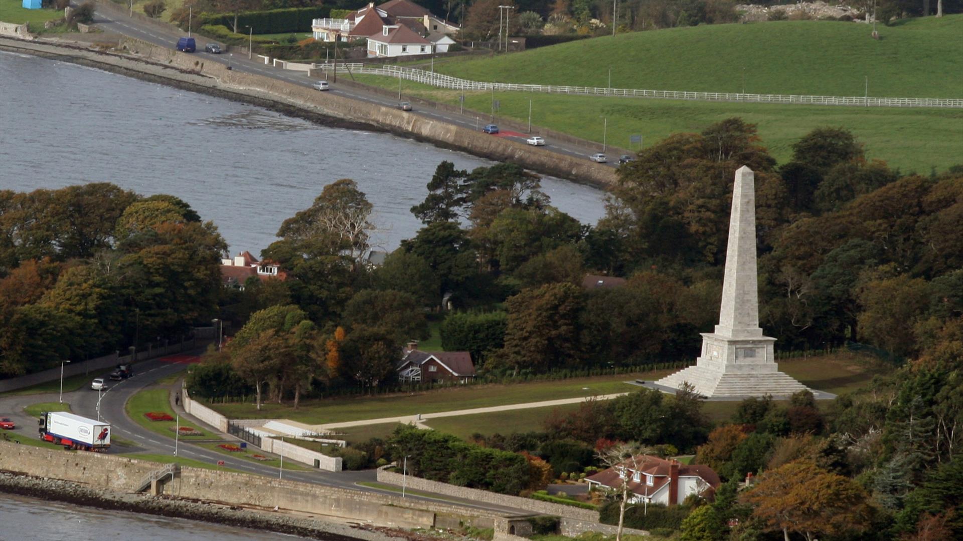
Discover the striking Ross Monument, an Egyptian-style obelisk erected in 1826 on a hill overlooking Rostrevor to commemorate Sir Robert Ross and his victory at Bladensburg during the War of 1812–15. Set within a dramatic landscape, this unusual monument offers both historical interest and panoramic views across Carlingford Lough.

Visitors are invited to explore the site at their own pace, taking in its unique design and scenic setting, or join one of the guided tours taking place on both days  to learn more about the story behind the monument and its connection to international history.

Whether visiting independently or as part of a tour, this is a memorable opportunity to experience a distinctive and lesser-known heritage site in a truly spectacular location. 

Guided Tour  Sat & Sun 14:00

Facilities

Accessibility

  • Ramp / Level Access

Guide Prices

Ticket TypeTicket Tariff
TicketFree

Please contact the organiser for any further information that's required.

Book Tickets Online

Add Ross Monument EHOD 2026 to your Itinerary

Close window

Call direct on:

Tel +44 (0) 28 9082 3207

Map & Directions

Opening Times

EHOD (12 Sept 2026 - 13 Sept 2026)
DayTimes
Saturday - Sunday09:00 - 17:00

What's Nearby

  1. Kilbroney Park features riverside walks and an arboretum. There is a two-mile forest…

    0.89 miles away
  2. This beautiful area has superb views and good walking routes over Carlingford Lough.…

    0.96 miles away
  3. Our play farm offers a huge indoor soft play area with four dragon slides and a massive…

    1.31 miles away
  1. 'Cill Bhronaigh', or Bronagh’s Church (12th century), is located in the graveyard just…

    1.34 miles away
  2. Warrenpoint Beach is located alongside the Mourne Mountains on the shores of Carlingford…

    1.56 miles away
  3. Excellent example of a tower-house and bawn built about 1568 at a point where the Newry…

    2.94 miles away
  4. Known locally as the ‘King’s Ring’, this court tomb has a prominent position in the…

    4.57 miles away
  5. "Where the Mountains of Mourne sweep down to the sea" (Percy French) The popular song has…

    4.6 miles away
  6. Commanding the mouth of Carlingford Lough, the Castle has an eventful history. It was…

    6.11 miles away
  7. Kilnassagart Inscribed Stone, in the south of County Armagh, is regarded as being one of…

    7.08 miles away
  8. Leisleitrim Fort is a fine example of a multivallate rath ( a rath with several banks and…

    7.19 miles away
  9. Dating from the Iron Age period around 10 BC, the enclosure comprises two roughly…

    7.19 miles away
  10. Bagenal’s Castle located in historic Newry is a 16th century fortified house and…

    7.2 miles away
  11. This is undoubtedly the most commanding building in Newry and is arguably the most…

    7.34 miles away
  12. South of the County Armagh village of Jonesborough lie the ruins of Moyry Castle, built…

    7.37 miles away
  13. Cranfield West offers a gently sloping, mainly sandy beach located at the entrance to…

    7.39 miles away
Previous Next

Map & Directions

View Maps and Visitor Guides
View what Mourne Gullion Strangford has to offer and some of the best things to see and do during a visit.
E-newsletter sign up
Sign up for the Mourne Gullion Strangford newsletter for inspiration and travel tips.
Back to Top

Visit Mourne

Tourism Northern Ireland

Geopark

Don't Miss